Satisfied that I would no longer have to use walls, other vehicles, morbidly obese people, etc. to stop the RV instead of using my brakes (see last post), we set off towards Death Valley.
Death Valley was christened in the 19th century by gold prospectors who crossed the valley on the way to the gold fields, and no doubt encountered the searing heat of the subtropical desert climate. Temperatures regularly exceed 45°C in the summer, the highest ever recorded being 57°C!
It's basically an immense basin surrounded by mountains. The air is clear and dry, there's very little plant cover and the terrain plunges to a depth of 282ft below sea level. The sun heats the ground quickly and the higher air pressure at such low altitude traps the hot air near the ground and creates hot wind currents that circulate around the valley, effectively turning it into a huge convection grill.
We arrived in late October to temperatures of about 40°C. Considering I only wear a coat for about 2 days a year in the UK, I must admit this was a bit beyond my comfort zone for a day's wandering in the desert. We still saw plenty though.
We started at Ubehebe Crater (which has since been renamed "Heeby Jeeby Crater", at least in Sharon's vernacular!). It's a half-mile wide volcanic crater, the product of the largest of several steam explosions in the area.
We started at Ubehebe Crater (which has since been renamed "Heeby Jeeby Crater", at least in Sharon's vernacular!). It's a half-mile wide volcanic crater, the product of the largest of several steam explosions in the area.
These eruptions scattered fallout debris across a large area, causing the dark grey scorched land effect all around.
The crater seems to cause the build up of some pretty strong gusts of wind. I tried to tell Sharon she'd be blown away. She seemed to think I was taking the piss. Me?!
Driving further down the valley, we reached Mesquite Flats, a huge field of sand dunes. I was curious to see why one area covered in sand was such a focal point in a valley which seems to be predominantly covered in the stuff anyway. Having been there, it makes sense in that it's a kind of oasis of much finer, lighter sand than elsewhere in the valley, carved by the wind into huge waves and interspersed with mesquite plants. It's more like the Hollywood image that the word "desert" conjures in your mind, in fact this is where many sand dune scenes in movies have been shot, including Star Wars.
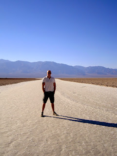
On to Badwater Basin next, one of the lowest points in the western hemisphere at 282ft below sea level, and easily the hottest part of the valley that we saw. It primarily consists of a huge expanse of flatland which is occasionally flooded with rainfall. The intense heat causes quick evaporation, leaving behind salt crystal deposits.
That huge honeycombed salt crust stretches for miles, but there is a small, spring-fed pool of water near the road which, because of the surrounding material, is unsafe to drink, hence the name "Badwater". Apparently, at some point in its history, an explorer led his horse to the water's edge to drink and even the horse was having none of it.
We hiked some of the Golden Canyon trail...
...but to be honest the heat got the better of me, so it was a short hike.
I think I saw this bit in "The Hills Have Eyes" anyway, so probably for the best....
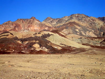
Our last stop before leaving the valley was Zabriskie Point, which gave us some impressive panoramic views of part of the valley.
We were also entertained for a while by a young kit fox trying to hunt a large crow on the rock face. Amazing to think that anything manages to survive here really. There's even a tribe of Native Americans, the Timbisha, that calls Death Valley home.
Many Americans we've met have expressed an inexplicable desire to visit the UK despite the crappy weather; I wonder if the Timbisha would feel the same. Unfortunately my Timbisha-ese is a bit rusty, so we'll never know.
Many Americans we've met have expressed an inexplicable desire to visit the UK despite the crappy weather; I wonder if the Timbisha would feel the same. Unfortunately my Timbisha-ese is a bit rusty, so we'll never know.


.JPG)

0 comments :
Post a Comment